
Technology
Mission Drishti: GalaxEye's Progress in Earth Observation Using OptoSAR Technology
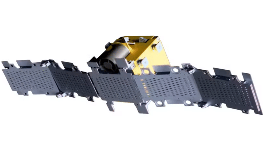

Bengaluru-based startup GalaxEye launched its Mission Drishti on May 3, introducing what is being called the world’s first OptoSAR satellite and also India’s largest privately built Earth observation satellite. The 190 kg satellite was deployed into orbit aboard SpaceX’s Falcon 9 rocket and is designed to enhance the way Earth observation data is collected, making imaging more reliable and consistent regardless of weather conditions or time of day. Earth observation satellites are systems placed in space to monitor the planet’s surface, atmosphere, and oceans. They play an important role in areas like weather forecasting, environmental tracking, agriculture, disaster response, mapping, and defence planning. Depending on their design, these satellites either capture optical images similar to photographs or use radar technology that can operate through clouds and in darkness.
What makes Mission Drishti different is its approach to imaging. Most satellites rely on either optical or radar systems, each with its own strengths and limitations. Optical sensors provide clear visuals but need sunlight and clear skies, while radar systems work in all conditions but generate different types of data. Typically, data from multiple satellites is combined to overcome these gaps, but this often leads to challenges in aligning images taken at different times and angles.
Mission Drishti addresses this issue by integrating Electro-Optical (EO) and Synthetic Aperture Radar (SAR) sensors into a single platform. This allows both types of data to be captured simultaneously, ensuring better consistency and reducing dependence on external conditions. According to GalaxEye co-founder Suyash Singh, optical and SAR sensors usually observe different areas at different angles, but their system synchronises both to focus on the same location at the same time, removing the need for manual data alignment.
The satellite is based on OptoSAR technology, which combines optical and radar imaging in one system. This integration allows for more detailed and reliable Earth observation. In practical terms, it can help during natural disasters by identifying flooded regions, damaged infrastructure, and safe zones in a single pass, even when cloud cover or poor lighting would normally block visibility.
Such capabilities are expected to be useful across multiple sectors including defence surveillance, agricultural monitoring, disaster management, and infrastructure development. It also opens the door for continuous monitoring of borders, better crop assessment during monsoon seasons, and improved tracking of large-scale construction projects. Reports suggest that a future constellation of such satellites could provide year-round global coverage. This is particularly significant as India has previously relied on foreign satellite imagery in critical situations. GalaxEye plans to expand this system over the next five years to build a stronger and more independent Earth observation network while also meeting growing global demand for satellite data.
Artificial intelligence is also a key part of Mission Drishti. The satellite uses onboard AI processing powered by Nvidia’s Jetson Orin platform, allowing it to process part of the data directly in space instead of sending everything back to Earth. This reduces delay and speeds up the conversion of raw images into useful information. The satellite is capable of capturing imagery with a resolution of 1.8 metres, meaning each pixel represents a 1.8 by 1.8 metre area on the ground. This level of detail is sufficient to identify buildings, roads, and large vehicles, making the data useful for practical decision-making.
Other companies are also working in similar directions, including developments in orbital data processing satellites that use powerful GPUs to analyse data directly in space. These systems aim to further reduce the time required to turn satellite imagery into actionable insights. Mission Drishti has received recognition from national leaders as a major step forward in India’s space technology capabilities. It is seen as an important advancement in private-sector participation in space and a move toward strengthening India’s independent Earth observation infrastructure.