



News
India Maps 27 Arunachal Pradesh Locations Amid China's Renaming Attempts
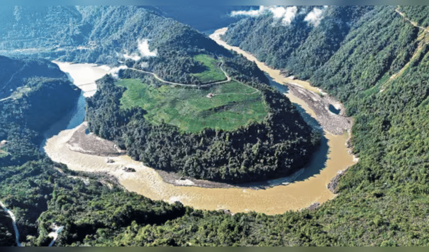

India has officially mapped 27 locations and geographical features in Arunachal Pradesh using their standard Indian names, in a move that comes amid China’s repeated attempts to rename places in the northeastern state. The latest exercise by the Survey of India includes villages, mountain passes, a high-altitude lake and sites associated with India’s military history. The move is significant as Arunachal Pradesh remains one of the most sensitive areas in the long-running India-China boundary dispute.
Among the locations included in the official mapping is Long Ju in Upper Subansiri district. The area holds historical significance in the India-China border dispute and witnessed a confrontation involving Chinese troops in 1959. Other locations covered in the exercise include Maja and Bisa, along with mountain passes such as Dzo La, Riza La and Pukur La. Thag La in Tawang district is another important location included in the updated map. The strategically significant pass is associated with the 1962 India-China war and the fighting that took place in the Namka Chu valley. The mapping exercise also includes Jaswant Garh, a memorial dedicated to Indian soldier Rifleman Jaswant Singh Rawat, as well as the Sher-e-Thapa Memorial.
Sambho Sarovar, a high-altitude lake, has also been included, along with several settlements and other geographical features across Arunachal Pradesh. The move comes against the backdrop of China's long-running campaign to assign Chinese names to places in Arunachal Pradesh. Beijing refers to the Indian state as “Zangnan” or “South Tibet” and claims sovereignty over large parts of the region. India has consistently rejected these claims and maintained that Arunachal Pradesh is an integral and inalienable part of the country.
China has released several lists of alternative names for locations in Arunachal Pradesh since 2017. New Delhi has repeatedly dismissed the exercise, arguing that changing the names of places cannot alter the reality of their status or India's sovereignty over the territory. The inclusion of the 27 locations in the official Survey of India mapping system gives the latest Indian response an administrative as well as strategic dimension. Accurate official mapping is particularly important in border regions, where geographical names and maps can form part of broader territorial narratives.
Several of the newly mapped locations are also closely connected with India's border history. Long Ju and Thag La, for example, are associated with major episodes in the development of the India-China boundary dispute, while memorial sites such as Jaswant Garh serve as reminders of India's military history in the region.
India and China continue to have unresolved differences over their Himalayan boundary, with Arunachal Pradesh remaining a major point of contention. China does not recognise the McMahon Line, which India considers the basis of the boundary in the eastern sector, while New Delhi has consistently rejected Beijing's territorial claims over Arunachal Pradesh. Although assigning or standardising geographical names does not by itself determine sovereignty under international law, the latest development highlights the continuing importance both countries attach to maps, names and territorial narratives.
India's decision to formally record these 27 locations with their standard names therefore comes as more than a routine cartographic update. It reinforces New Delhi's long-standing position that Arunachal Pradesh is Indian territory and that attempts to change place names cannot alter the ground reality. The development also comes as India and China continue efforts to manage tensions along their disputed border. While diplomatic engagement between the two countries has increased at various stages, the disagreement over Arunachal Pradesh remains unresolved and continues to influence their broader bilateral relationship.